TRAIL JOURNAL
/ June 24, 2022
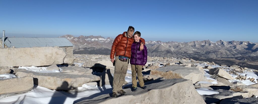
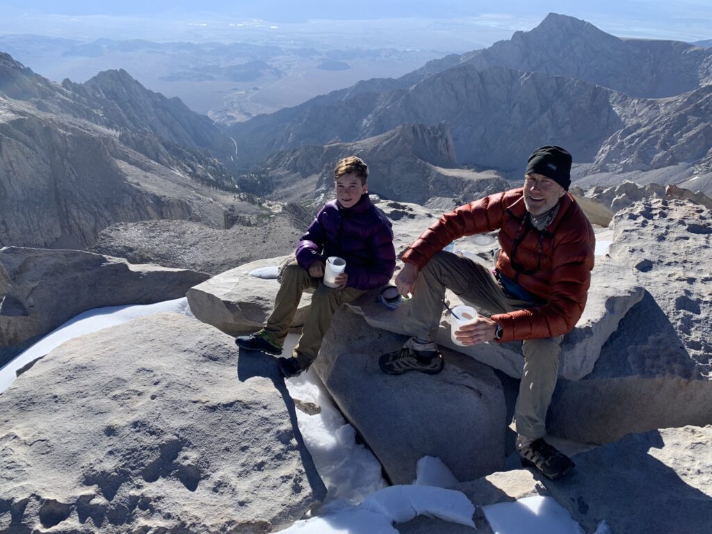
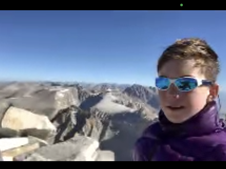
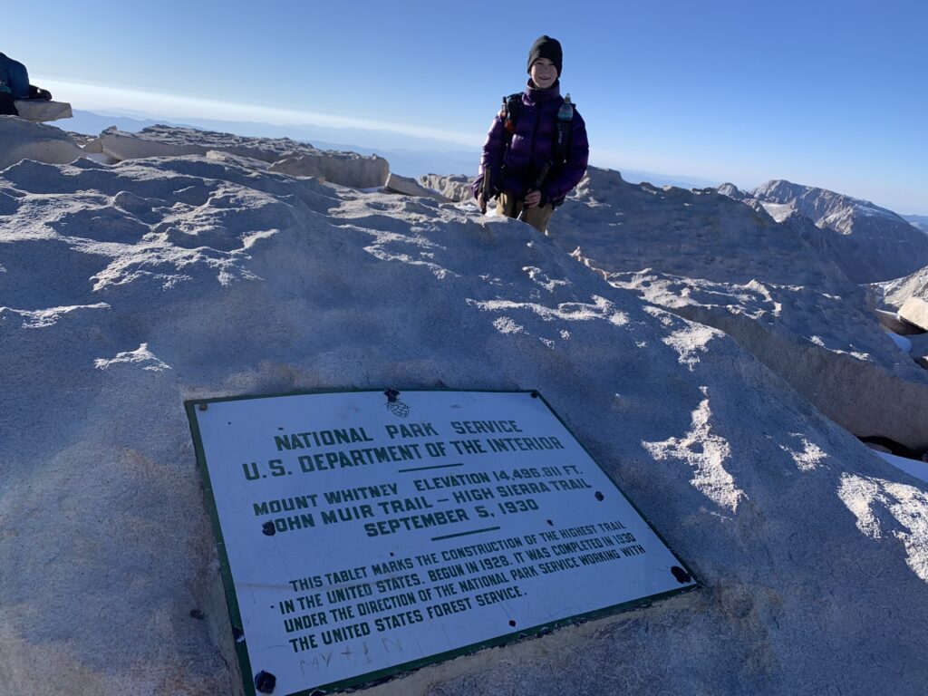
It was hard work to get to the top, but it felt incredible to be there with Dad. We were at 14,505 feet! I can’t believe we had climbed a mountain higher in elevation than Seattle’s glacier-topped volcano, Mt. Rainier! There was another hiker up there, and he kindly took some photos of us. There was a lot to look at, but I was really hungry. We’d brought breakfast in our packs, so we took a seat with a good view and ate.
Some people bring their sleeping bags up to stay warm while sitting at the top. I think it’s a good idea. We didn’t really need extra warmth, but it probably would have been nice (even with near-perfect conditions). Dad thought it probably wasn’t a good idea to sit for too long anyway, given our legs had to get us back down again!
The straight line-of-sight between us and Lone Pine gave us a *big* surprise: cell phone connection! So guess what we did? We FaceTimed Mum and Lachlan! Haha! Mum had been watching our progress on the satellite tracker, and she was pretty happy with just getting to do that. It was so much fun to surprise her. 🙂 Dad says it’s really important to include our ace Support Team A, and what a great way to do it. I’d recommend it!
There’s other stuff to do at the summit too. We signed the visitor’s log and read a few of the comments from previous days. Some people evidently had a less enjoyable climb than we did!
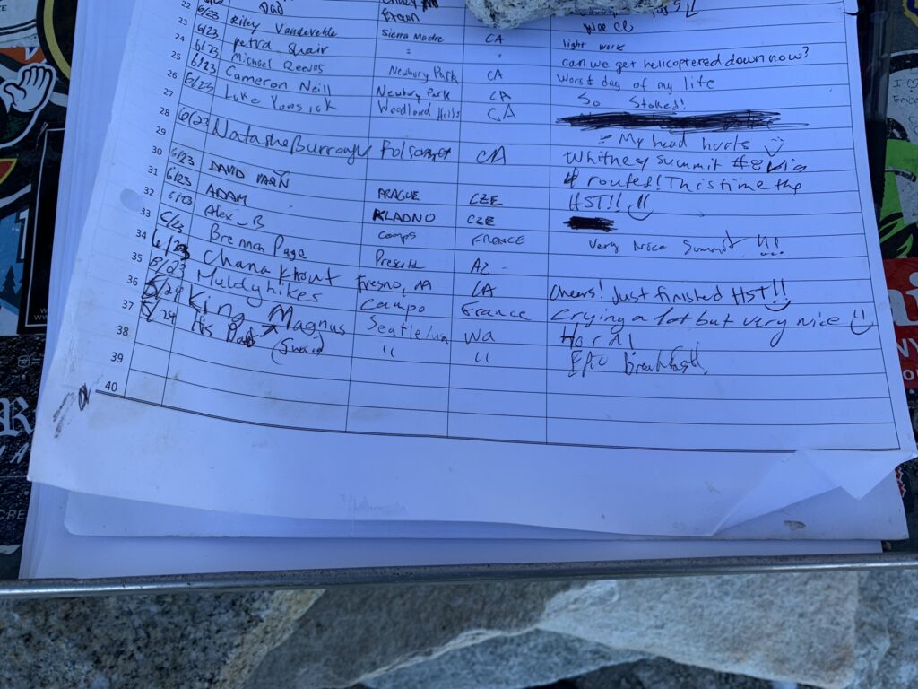
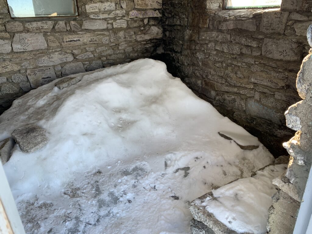
I signed with my trail name and my comment was “Hard” … because the hike was hard. Dad’s comment was “Epic breakfast!” … because the hike was that too! 🙂 Next we took a look at the Mt. Whitney Hut. Fun Fact: it’s the highest permanent structure in the contiguous United States. It was built more than 100 years ago as a place for scientists to safely look at planets and study high altitude phenomena before planes could fly that high. However, today the hut has a metal roof, which makes it particularly attractive to lightning. One hiker was even killed by lightning while sheltering in it during a storm in 1990. So even though it is open for “emergency” purposes, staying in the hut isn’t a great idea.
Another Fun Fact: the 1930 plaque at the summit states the elevation of Mt. Whitney to be 14,496 feet. But maps today show its elevation to be 14,505. Has Mt. Whitney grown 9 feet since 1930? Well, geologists say that Mt. Whitney is growing, along with other mountains in the Sierra Nevada. But the height difference is due to a change in how vertical distance is calibrated in North America. The new measure was implemented in 1992, so if you have an old map of Whitney, it might still show the old elevation.
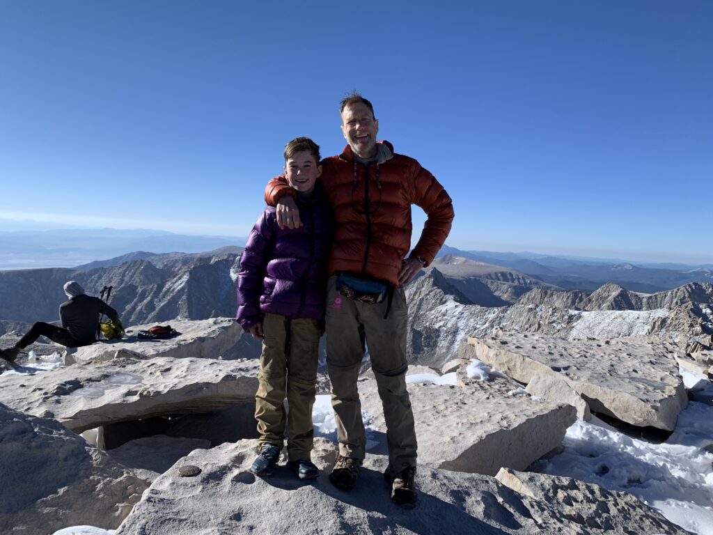
For all our preparation for this epic hike, maybe the hardest part was getting up early enough to be up there for sunrise. But once we were up there, I think it was worth the effort. And now, on the way down we get to see all the things that we couldn’t really see clearly on the way up. I know that many hikers get cold, feel unsafe, or exhausted, or generally don’t enjoy their time climbing Mt. Whitney. The fact that I had such a good time has a lot to do with my Dad. His planning, reading about and testing every little piece of equipment, minimizing pack weight, maximizing trail nutrition, and running cracking training hikes for us both mean that I am free to just enjoy the hike. Everyone tells me how lucky I am to be hiking the PCT with my Dad, but they don’t know the half of it. Thanks, Dad.
- Magnus!